resources
we’re dedicated to sharing our resources, experiences and ideas that will help shape the future of drone, robotic and visual data technologies.


sharing our resources, experiences & ideas
The future of drone, robotic, and visual data technologies is an incredibly exciting time! With new advancements in AI, machine learning, and computer vision... Drones are becoming more autonomous and capable of performing complex tasks with precision.
As we share our resources, experiences, and ideas, we're collectively contributing to the shaping of this exciting future. The collaboration between industries, academia, and regulatory bodies are crucial. As we continue to innovate and show good stewardship, the future of drone and robotic technologies is bright. It's one that we can all look forward to with enthusiasm. Let's continue to explore, where technology can open doors to many possibilities... Available soon!
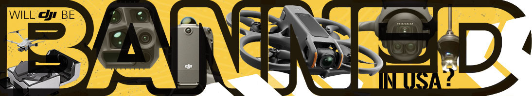
the end of an era in united states!
___
Here is a statment to help the general public understand that the recent FCC ban on future foreign-manufactured drones and their components could have a significant impact on everyday life eventually.
Section 232 - The U.S. Government is about to launch an economic security audit on Chinese-manufactured drones. Is this the final nail in the coffin for foreign-manufacturers in America's market, paving the way for more drone-tech innovations in a distant future? Only time will tell.
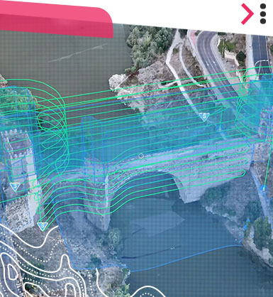
The dawn of autonomy flights beyond sight
___
BVLOS: Part 108 isn’t just another FAA rule — it’s the bridge between UAV pilots and autonomy. The image says it all: a single operator wired into a digital ecosystem, overseeing multiple drone missions through live mapping, analytics, and visual telemetry. This is where the industry’s heading — multi-aircraft oversight, advanced data visualization, and ground control that feels more like a command center than a hand-held controller with a laptop in the back of your vehicle. Learn More
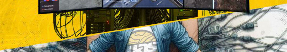
new era of intelligent flight operations
___
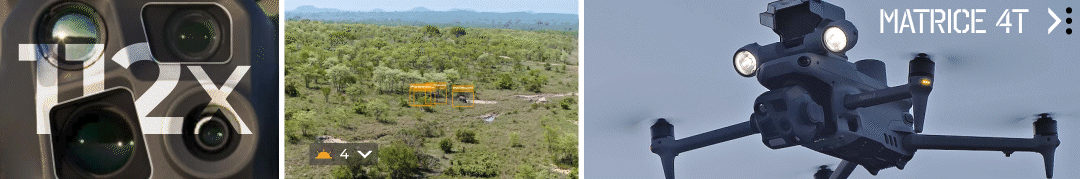
While you're here, take a peek at this hands-on review. More in debt zoom, improved thermal imagery with artificial intelligence object detection, real-time measurement, and low light capabilities. It's like the Mavic series married the Matrice series, and this will be their kid. BTW, the aircraft/remote are not fully waterproof. Unfortunately, we're still waiting for a midsize foldable weatherproof model with a changeable payload (maybe the new M40 if possible).
___
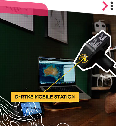
Use NTRIP Instead
A revolutionizing the way we approach precise location tracking. NTRIP cuts out the middleman and allows for real-time, centimeter-level accuracy in applications like surveying and mapping. It's a game-changer for professionals, offering an efficient alternative to traditional methods.
___
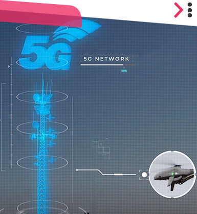
Industry Forecast
Deploying drones for quicker response times to missions with real-time data collection, the possibilities are endless. The future of drone technology powered by 5G, promises to enhance safety, streamline operations, and even support the exploration of remote locations with ease and efficiency.
___
BVLOS Operations
The integration of AI in BVLOS operations is revolutionizing the way we approach autonomous flight planning and execution. With advanced algorithms, drones can now perform complex missions with minimal human intervention and navigate through diverse environments in real time.
___
Flight Planning App
Dronelink is a versatile flight planning application for drones, compatible with various models including DJI and Autel. It offers a range of automated and semi-automated tools for mapping, inspections, and data capture. Suitable for industries like construction, agriculture, film, etc. Check it out when you have a chance

___
Drone Support & Repair
For drone enthusiasts and professionals alike, having reliable support and repair services is crucial. Some offer a comprehensive service or get a replacement. For those seeking specialized services, Drone Nerds is the go-to, offering everything from preventative maintenance to repair services tailored for UAV technology.
___
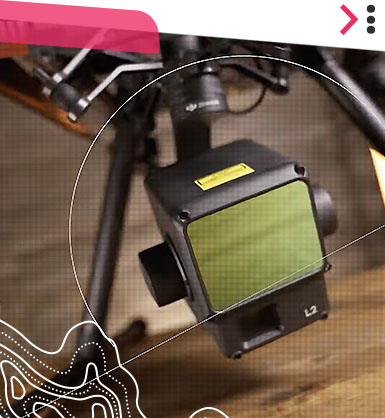
LiDAR L2 Tech Review
The DJI Zenmuse L2 represents a significant advancement over the L1 model, offering enhanced capabilities for professionals in aerial surveying. With improvements in range, resolution, and data collection efficiency. The L2 allows for more detailed and accurate mapping with a larger RGB sensor...
___
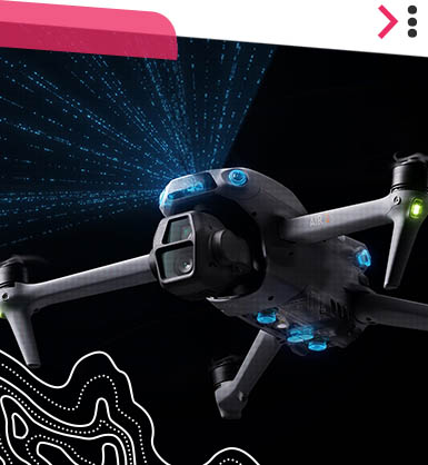
Air 3S Revolutionary with LiDAR
Air 3S introduces a game-changing Smart RTH (Return to Home) mode with a new lidar sensor. It’s the first drone capable of indoor takeoff without GPS and can autonomously return to the exact takeoff point.
___
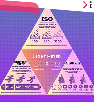
The Exposure Triangle Fundamentals
The exposure triangle is the foundation that every drone video creator needs to know! We breaks down and shows you how to get your footage looking as professional as possible!
___
How we create 3D asset from a drone
Turning buildings into 3D models using drones is easier than you think with the right hardware and software. If you ever wonder how they capture amazing models, this video is for you! Check it out when you have a chance.
Let us help answer your questions or chat with Ariel, our Ai-Bot on the right-hand corner. We're here to assist!
Hours of Operation: Tue - Sat | 8am - 5pm

© 2021-26 UASSIST IS A DRONE SERVICE PROVIDED BY KWARE DESIGN, LLC. ALL © & TM MENTIONED BELONG TO THEIR RESPECTIVE OWNERS. ALL RIGHTS RESERVED. ALL OPERATIONS BY KWARE DESIGN, LLC. COMPLY WITH ALL FEDERAL AVIATION ADMINISTRATION AND STATE LAWS.